
Former PG&E Engineer Raises $26M to Build Google Maps for the Underground
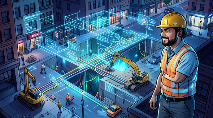
TL;DR
- A former PG&E engineer has raised a $26 million Series A to scale his startup, which is building a comprehensive digital platform often described as "Google Maps for the underground" to map buried utilities and infrastructure.
- The AI-powered platform aggregates fragmented public records, utility as-builts, and geospatial data to give construction firms and utilities instant, accurate subsurface maps, dramatically cutting permitting red tape and pre-construction delays.
- By providing a single source of truth for what's buried below, the technology aims to prevent costly and dangerous utility strikes, project overruns, and safety hazards that plague the construction industry.
From Blackouts and Backhoes to a Breakthrough Idea
Every construction project starts with the same high-stakes guessing game: what's buried underneath? For a former engineer at Pacific Gas and Electric (PG&E), that question wasn't academic. Seeing firsthand how inaccurate, outdated, and siloed records of underground infrastructure led to project delays, costly utility strikes, and serious safety risks, he left the utility giant to solve the problem from the outside.
That experience is now the foundation of his startup, which is on a mission to create the most complete and accurate map of the underground ever built. The company announced this week it has raised $26 million in Series A funding to accelerate that vision, positioning itself as an essential layer of infrastructure for the future of construction, utilities, and urban development.
Investors Bet Big on Mapping the Unseen
The $26 million Series A round was led by prominent Silicon Valley venture firms with participation from existing seed investors and strategic angels from the construction and energy sectors. The fresh capital brings the company's total funding to over $32 million and will be used to expand its engineering and geospatial teams, enhance its AI platform, and scale its coverage to major metropolitan areas across the United States.
Investors are betting that the startup can do for the subsurface what Google Maps did for the surface — turn a fragmented, analog world into a searchable, digital, and instantly accessible platform. The underground economy is massive but notoriously opaque, with trillions of dollars in buried assets including gas lines, water mains, fiber optic cables, and electrical conduits that are poorly documented.
How the "Google Maps for the Underground" Actually Works
The core problem the startup tackles is data fragmentation. Today, anyone planning to dig must navigate a labyrinth of 811 calls, municipal records, utility as-builts, and historical paper maps, many of which are decades old, hand-drawn, and contradictory. The process can take weeks and still leaves crews vulnerable to surprises.
The startup's platform solves this by using artificial intelligence and computer vision to ingest and standardize millions of disparate records. It pulls from city and county permitting databases, state DOT archives, utility company records, and satellite and street-level imagery to create a single, unified, and georeferenced map. Users can enter an address or draw a project boundary and instantly receive a comprehensive report detailing the location, depth, and type of underground utilities.
Unlike traditional utility locating services that require a technician on-site with ground-penetrating radar, the platform provides an instant desktop analysis for planning and permitting, with field-verification tools for crews on the ground.
Cutting Red Tape and Accelerating Permitting
For utilities and construction firms, the platform's biggest immediate value is speed. Permitting is one of the most significant bottlenecks in U.S. infrastructure development, often delayed by incomplete or conflicting underground data that forces multiple rounds of revisions and manual verification.
By providing a verifiable, up-to-date map upfront, the startup helps developers submit more accurate permit applications the first time, reducing approval times from weeks to days. General contractors and engineering firms are using the tool during the bid and design phase to create more accurate cost estimates and avoid change orders, while utilities are using it to streamline their own design and maintenance workflows and better manage their vast networks of buried assets.
Preventing Strikes, Delays, and Disasters
Beyond efficiency, the stakes are about safety and cost. According to industry estimates, an underground utility line is struck every 60 seconds in the U.S. during excavation, leading to service outages, project shutdowns, injuries, and even fatalities. These strikes cost the construction industry an estimated $30 billion annually in direct and indirect costs.
By giving excavators a clearer picture before they break ground, the platform significantly reduces the risk of hitting a gas line or severing a fiber optic cable. For job sites, that means fewer emergency shutdowns, fewer injuries, lower insurance costs, and projects that stay on schedule and on budget. The company reports that early customers have seen a dramatic reduction in utility strikes and design-related delays.
What Comes Next for the Underground
With the new Series A funding, the company plans to move beyond mapping to become a full workflow platform for anything that touches the underground. Upcoming features include automated conflict detection that flags where a proposed design intersects with existing utilities, collaborative tools for engineers and excavators, and real-time updates from field crews to continuously improve map accuracy.
The long-term vision is to build a living, dynamic map of the subsurface that updates in real time as new infrastructure is built and old infrastructure is replaced. As the U.S. pushes to modernize its aging infrastructure, expand broadband, and upgrade its energy grid, a reliable map of what's already underground is no longer a luxury — it's a necessity.

Get All The Latest Updates Delivered Straight To Your Inbox For Free!